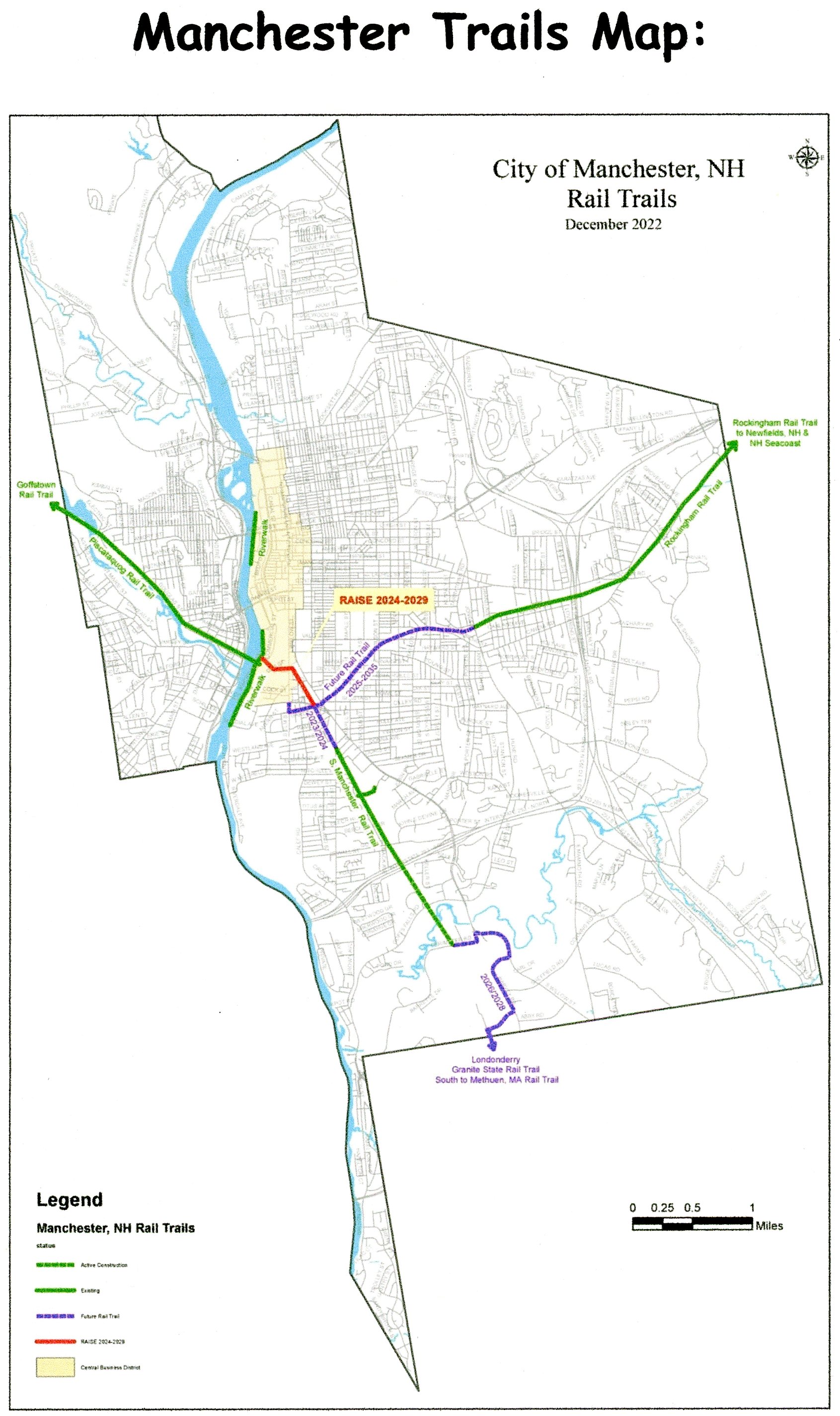
MANCHESTER TRAILS:
HERITAGE TRAIL:
PISCATAQUOG TRAIL:
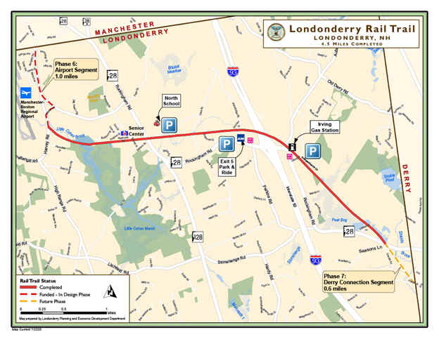
ROCKINGHAM RECREATIONAL RAIL TRAIL:
SOUTH MANCHESTER RAIL TRAIL:
MANCHESTER, NEW HAMPSHIRE
-BIKE IT OR HIKE IT-
Last Updated: September 20, 2025
Length: Heritage Trail; 1.2 miles
Heritage Trail; Bedford Section; 1.8 miles
Piscataquog Trail; 2 miles
South Manchester Rail Trail; 2.4 miles
Rockingham Recreational Trail; Portsmouth Branch; [Manchester/Auburn Section]; 3.1 miles
Rockingham Recreational Trail; Portsmouth Branch; 28 miles
Difficulty: Heritage Trail; Easy. Paved trail.
Heritage Trail; Bedford Section; Moderate. Mostly flat with varying trail surfaces (stone-dust, hard packed dirt & grass).
Piscataquog Trail; Easy. Paved, flat rail trail.
South Manchester Rail Trail; Easy. Paved, flat rail trail.
Rockingham Recreational Trail; Portsmouth Branch; [Manchester/Auburn Section] Easy. Flat, stone-dust rail trail.
Rockingham Recreational Trail; Portsmouth Branch; Moderate. Hard packed dirt & gravel rail trail.
Directions:
To check out the Piscataquog [Eastern End] & Heritage/Riverfront Trails in Manchester [Central Section]; From I-293 take exit 5 to Granite St and head west. Take your first left onto 2nd St. As you approach the old RR trestle crossing over the road turn left into the parking lot. The Piscataquog Trail runs along the old RR bed above. There are stairs leading up to the trail, however, if biking travel underneath the RR bridge and turn right up Blaine St, then right on 3rd St and you'll come to the trail. The Hands Across the Merrimack Bridge is just along the left and allows you access to the Heritage Trail.
To check out the Heritage Trail in Bedford [Southern End]; From the junction of I-293/Route 101 take the exit for Route 3 south. Take a left onto Moores Crossing Road (you'll see a brown sign) and follow to a parking area at its end.
To check out the South Manchester Rail Trail in South Manchester; From I-293 take exit 1 to S Willow St (Route 28) north. Turn left when you reach Spring Garden St, then left on S Beach St. You'll immediately spot the trailhead on your left. Turn left and follow the road to a parking lot next to the trail.
To check out the Rockingham Recreational Trail; Portsmouth Branch in Manchester-Auburn [Eastern Section]; Take exit 1 off of Route 101 to Route 28B (Londonderry Turnpike) and head south. After passing through the roundabout you'll cross the trail. Turn left into the Front Park parking lot. The trail heads west to Manchester and east, past Massabesic Lake towards Newfields.
The Manchester Trails consist of 4 intersecting Trails all connecting in the center of Manchester, with the Hub located at the Eastern End of the Hands Across the Merrimack Bridge. Currently only the Piscataquog & Heritage Trails interconnect. The other 2 Trails are the South Manchester Rail Trail & Rockingham Recreational Trail; Portsmouth Branch. From the Hub, the Piscataquog Trail travels Northwest, across the Hands Across the Merrimack Bridge to Goffstown, where it connects to the Goffstown Rail Trail . For more information visit; PISCATAQUAG TRAIL/GOFFSTOWN RAIL TRAIL . From the Hub, the Heritage Trail travels North, to downtown Manchester & South, along the Merrimack River. The Heritage Trail-Bedford Section is located on the Western Side of the Merrimack River in Bedford and travels North-South along the river. The Rockingham Recreational Trail; Portsmouth Branch travels Northwest, from Manchester, through Auburn, Candia, Raymond, Epping and Newfields. For more information visit; ROCKINGHAM RECREATIONAL TRAIL; PORTSMOUTH BRANCH . The South Manchester Rail Trail travels South, to Londonderry, where it continues South, along the regional Manchester & Lawrence Rail Trail which includes: The Londonderry Rail Trail, Derry Rail Trail, Windham Rail Trail, Salem Bike-Ped Corridor, Methuen Rail Trail (MA) and Lawrence Rail Trail (MA), which has not yet been developed.
The South Manchester Rail Trail & Heritage Trail are part of the state wide GRANITE STATE RAIL TRAIL, a proposed 120 mile trail extending from Methuen MA Northwest, to Lebanon NH. The South Manchester Rail Trail follows the railroad bed of the former Manchester and Lawrence Branch of the Boston and Maine Railroad. The Piscataquog Trail follow the abandoned Boston & Maine RR corridor and the Rockingham Recreational Trail; Portsmouth Branch, follows the former B&M RR; Portsmouth Branch. The Heritage Trail is part of the NH HERITAGE TRAIL . This is a trail program run by the State of New Hampshire to provide a link between communities and preserve recreational and historical corridors in New Hampshire.
Piscataquog Trail/Heritage Trail:
Starting from the Hands Across the Merrimack Bridge; The Piscataquog Trail [Eastern End] & Heritage Trail [Central Section] intersect here along the Eastern Side of the Merrimack River in Manchester at the Hub.
Heritage Trail:
The Heritage Trail travels North & South along the Eastern Side of the river. From the end of the bridge a paved path leads down to the trail.
Heading North; The wide, paved Heritage Trail travels high above the river and takes you past the Bank of NH Delta Dental Stadium, home of the NH Fisher Cats to Line Dr and the Stark Landing boat launch at 0.2 miles. Travel right out Line Drive and pick up a paved path out to S Commercial St.
Note; The paved S Commercial Street Path travels right, South, alongside S Commercial St and next to some RR tracks. When you pass by a parking lot on your left, spot an old brick Manchester B&M Switch Tower across the RR tracks. This is where the old RR line for the South Manchester Rail Trail intersected the existing tracks. The path continues past the stadium, ending after 0.3 miles.
Heading left, North, the paved S Commercial Street Path travels alongside S Commercial St out to and across Granite St at 0.6 miles. Travel on-road, along Commercial St (Caution no shoulder/narrow sidewalk). Turn left down Waumbec St and you'll come to the brick lined Riverwalk Trail after 1 mile. Heading right, North, alongside the Merrimack River after 0.7 miles. Check out the old bridge piers still crossing the river and all the old brick mill buildings. Pass by a promenade of stairs that lead down to the rivers edge. An informational sign here as well. Travel under Bridge St (parking located all along this trail. Metered except on weekends) and the trail ends after 1.3 miles.
Note; Another section of the Heritage Trail is located North, in Stark Park. I haven't checked it out.
Heading South; The wide, paved Heritage Trail travels above the river and through the woods. You come to Riverwalk Way St after 0.2 miles, where the trail then utilizes the old paved road. You travel underneath the Queen City Ave bridge at 0.4 miles and pass by some industrial buildings. A chain link fence separates you from the old mills, but makes the trail narrower. The trail currently ends at the junction of Dunbar St & Sundial Ave after 0.6 miles. Kiosk here. Future plans call for the trail continuing South, traveling underneath I-293 and crossing over the Merrimack River to Bedford, where you can connect to the Heritage Trail; Bedford Section. See Below.
Piscataquog Trail:
Starting from the Hands Across the Merrimack Bridge in Manchester [Eastern End]; You travel Northwest, across the Merrimack River on the wood decked, refurbished RR trestle bridge. Great views. After crossing the river you travel over I-293 and come to a set of stairs leading down to the 2nd Street parking lot. You then cross over 2nd St via an old RR bridge and cross 3rd St at grade (here you can bike down to the parking lot). The paved trail is wide and travels through an urban/residential area. A cross-walk takes you over busy S Main St at 0.4 miles. You then travel through a below grade cut and through a couple of tunnels underneath Parker St and Granite St. The trail becomes more wooded as you travel above the Piscataquog River on your left along a berm at 0.7 miles. You come to a parking lot on your right off Douglas Street at 1.3 miles, then some athletic fields along both sides of the trail. Come to Electric Ave at 1.7 miles, just below the Nazaire Biron Bridge (Pinard St/Kelley St).
Note; A Spur Trail left, leads down to the West Side Arena and another Spur Trail right takes you up to Kelley St.
Continue straight across the Piscataquog River via an arched iron bridge. Dam to your left. Then travel along a high berm to the Goffstown town line at 2 miles where the trail continues along the Goffstown Rail Trail .
Heritage Trail; Bedford Section:
Starting from the Moores Crossing Road parking lot in Bedford [Southern End]; Porto-Potty and Map Board.
Note; Heading South; Across the road the trail quickly ends behind a business next to some RR tracks.
Heading North; The narrow stone-dust Heritage Trail-Bedford Section passes by some picnic tables and travels along a transmission line. Soon you'll come to a high overlook of the Merrimack River, as well as, an informational sign and picnic tables. You have a good view of a RR trestle crossing the river. After crossing a small bridge the trail consists of hard packed dirt & grass as it parallels the river. Keep left when the trail splits and head up a small embankment. You'll cross a iron arched bridge over a brook where the trail widens at a 0.5 miles. The trail splits again near some condos, bear left and follow the grassy trail over a second iron bridge. You come to a pump house at 0.9 miles. Travel left up the paved access road and then turn right following a dirt road underneath I-293 to a large dirt parking lot at 1.1 miles. Continue straight through the parking lot to a wide grass & dirt trail through the woods. This mostly flat trail travels along the river and then narrows as it comes to an end at 1.8 miles. If you follow the sandy trails to your right you'll be rewarded with a sandy beach alongside the river. Very scenic.
South Manchester Rail Trail;
Currently a Gap, as of 2024, exists between the Northern End of the Londonderry Rail Trail at Harvey Road & the Southern End of the South Manchester Rail Trail at Perimeter Road.
The Manchester plan shows the trail crossing Navigator Rd and continuing straight alongside Kelly Ave to Bouchard St where it turns right up to Harvey Road.
Starting from Perimeter Road in South Manchester [Southern End]; I haven't checked out this new section yet. [No parking available] The paved South Manchester Rail Trail travels North, through the woods and quickly follows a berm to the rehabbed Cohas Brook Train Trestle over Cohas Brook, before traveling through a tunnel under Goffs Falls Rd at 0.4 miles. You then enter a more industrial/Commercial corridor. Travel under I-293 before coming to Gold St at 1 mile. I've checked out this next section. The partially shaded corridor continues North. Look left to spot some old railroad tracks paralleling the trail before you pass by Nutt Pond, with a couple of benches overlooking the pond. Pass by a Spur Trail to Precourt Park before coming to an intersection at 1.5 miles.
Note; Right, East, a Spur Trail takes you to Precourt Park. Left, West, takes you out to Mystic St.
Several more Spurs along the left side of the trail connect to local streets. You'll pass by a Spur for the Manchester Commons parking lot on your right before coming to a cross-walk over S Beech Street at 2 miles. The trail then continues right, North, along the old rail bed. I have not checked out this new section.
Note; You can continue North, along S Beech Street utilizing a combination of paved trail & sidewalk. Narrow in spots. Come to S Willow St at 2.2 miles.
The trail follows a residential/commercial corridor to Queen City Ave & Baker St after 2.4 miles.
Note; The future Central Manchester Rail Trail will continue North, along the old rail bed, out to Elm St after 0.7 miles.
Rockingham Recreational Trail; Portsmouth Branch:
Starting from Front Park in Auburn [Eastern Section]; Picnic tables overlook Massabesic Lake and a path to your left leads to the trail from the parking lot. Porto-Potty's located here as well.
Note; There is no crosswalk over Route 28B so USE CAUTION. Route 28B separates Auburn & Manchester.
Heading Southwest from Route 28B in Manchester; The stone-dust Rockingham Recreational Trail; Portsmouth Branch is flat as it follows the old rail bed past some ball fields on your left. After 0.25 miles you travel over a causeway between a marsh with the lake in the distance. You re-enter the woods at 0.5 miles and travel along a berm before crossing Lake Shore Dr. The trail is paved briefly as it travels through a tunnel underneath Peabody Ave at 0.8 miles. You come to the junction of Proctor & Candia Roads at 1.3 miles. Continue straight across Proctor Rd, then right over Candia Rd via a cross-walk to rejoin the trail. Yon soon travel through a marsh before crossing an access road and passing through a tunnel underneath I-93 at 1.8 miles. Another access road crossing and you travel along a wooded corridor surrounded by residential, industrial and commercial areas. Cross Page St. Come to Mammoth Rd and find a cross-light. The rail bed continues alongside Rite Aid, where a narrow dirt trail will bring you to Tarrytown Rd at 2.7 miles. The rail bed gets swallowed up here by a parking lot for Elliot Hospital. The section through Manchester is still in the design phase.
Heading Northeast from Route 28B in Auburn; The wide, stone-dust Rockingham Recreational Trail; Portsmouth Branch travels along the old RR bed, through the woods with Massabesic Lake along your right. You cross a boat-launch at 0.4 miles as the trail becomes hard packed dirt & gravel. After 0.75 miles you cross Candia/Manchester Rd and lose sight of the lake. Pass by an old RR Whistle Post on your left at 1 mile. + See; RR Whistle Post Below. You then travel along a causeway between a scenic marsh at 1.2 miles. After crossing the marsh, look down to your left to spot an old RR Mileage Marker reading M6/P34 (Manchester 6 miles/Portsmouth 34 miles). These old RR Mileage Markers were located every mile along the railroad. The trail here gets rougher with courser gravel. This is as far as I traveled, so I'm not sure of the trail conditions past here.
Old Railroad Equipment:
+
RR Whistle Post:
The Whistle Post,
was a post with a large "W" engraved or painted on it. This
meant the railroad engineers were to start sounding the trains Whistle.
The Whistle posts
were usually placed 0.25 miles
in advance of a road crossing,
bridges, tunnels and other points. Usually, there would be a post placed on both
sides of the crossing, covering both directions.
HH
CLICK HERE FOR MANCHESTER TRAILS MAP
BEFORE YOU SET OUT BE SURE TO READ THE
WAIVER OF RESPONSIBILITY AND DISCLAIMER
BIKE IT OR HIKE IT