CHELSEA GREENWAY:
CHELSEA, MASSACHUSETTS
-BIKE IT OR HIKE IT-
Last Updated: February 28, 2025
Length: Chelsea Greenway; 0.7 miles
Difficulty: Easy. Flat paved trail.
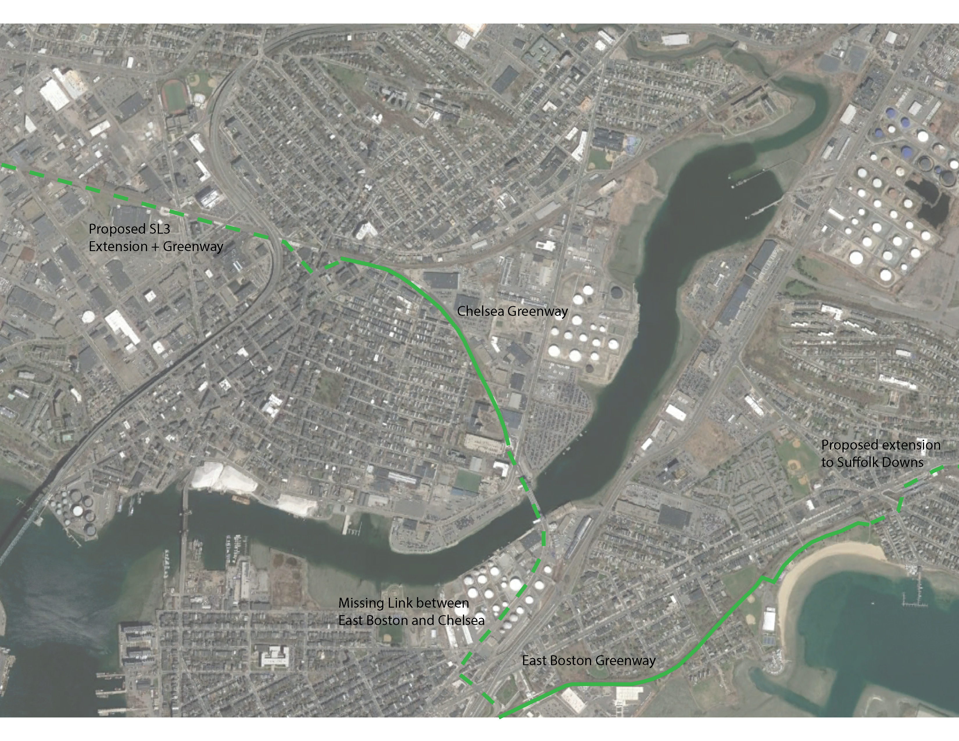
The Chelsea Greenway is a paved trail that travels aside the Silver Line rapid transit Busway.
Starting from Eastern Ave [Southeastern End]; The wide, paved Chelsea Greenway starts next to the Eastern Ave Busway Station. Map Board. Heading Northwest, the trail starts out along the Eastern Side of the Busway, but crosses over to the Western Side at Cottage St. Travel underneath Bellingham St before passing a spur to Library St at 0.3 miles and another spur to Highland St before passing the Box District Bus Station. A slight hill takes you up to and across Broadway (Busway travels under Broadway) before the trail ends at Chestnut St after 0.7 miles. Map Board. The Busway continues to Everett Ave and the Downtown Chelsea Station. BIKE SHARROWS along Chestnut St lead to Washington Ave, where a BUS/BIKE ONLY LANE travels Southwest and continues along Broadway to 3rd St.
Future plans will continue the Chelsea Greenway, West, alongside the Busway.
Future plans will build a trail from the Southeastern End of the Chelsea Greenway, North, along Eastern Ave, to the RR tracks. The trail will then continue East, alongside the tracks to the Chelsea Creek - Boston NHP site. See; EASTERN AVE CLIMATE RESILIENCE VISION .
Future plans will connect the Southeastern End of the Chelsea Greenway, South, across Chelsea Creek, to the Mary Ellen Welch Greenway in East Boston.
HH
BEFORE YOU SET OUT BE SURE TO READ THE
WAIVER OF RESPONSIBILITY AND DISCLAIMER
BIKE IT OR HIKE IT